[ Follow Ups ] [ Post Followup ] [ TAS BirdBoard ] [ FAQ ]
Posted by Ken Schneider on 18:52:31 11/28/11
In Reply to: Re: Bobcats posted by Lawrence Gladsden
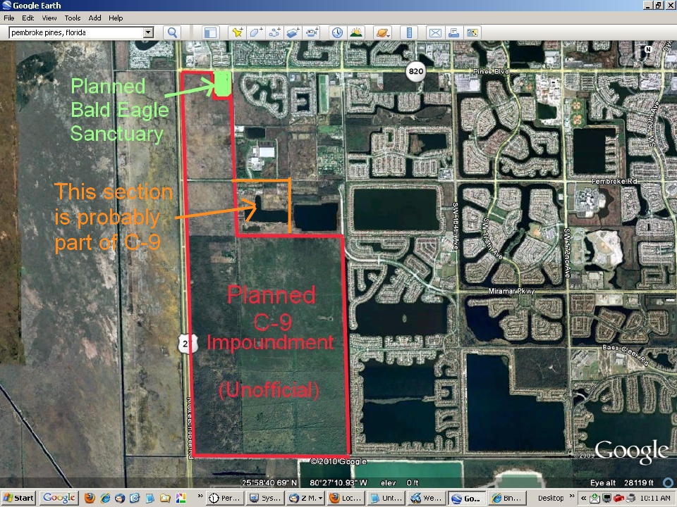
Larry, to my knowledge the present plan would extend the C-9 Impoundment from Pembroke Road all the way north to Pines Boulevard. The northern levee would extend from the edge of the "Eagle Forest" westward to US-27, then continue south all the way down to the Miami-Dade County line, then eastward to the SW 196th Avenue right-of way, north to Pembroke Road, then west to 209th Avenue right-of way, finally north to Pines Boulevard. The map in my blog shows its planned extent. It would not include the "eagle forest" which is owned by the City of Pembroke Pines. It would exclude the developed ares that include the recycling center and the police shooting range along 209th. This map the proposed C-9 Impoundment as it was presented by SFWMD to the Mayor's Bald Eagle Sanctuary Committee. It was "unofficial," and it includes one portion (outlined in orange)that had not been settled, so you may have more current information. Do let us know what you learn..
[ Follow Ups ] [ Post Followup ] [ TAS BirdBoard ] [ FAQ ]